Tramping for University Credit

I’m currently taking a class called Land Journey and Ethics, in which we are required to think about the way we treat the environment, and how we interact with nature. Although this class has nothing to do with my Linguistics degree, I thought it was quite appropriate considering the amount of tramping I intended to do in New Zealand. The main reason I took it was for the two field trips that would take place during the second term.

This blogpost is all about those two field trips – camping for class credit.


Port Hills Expedition

On the 14th and 15th, our first field trip took place. For me, a 30 minute bus ride away from uni doesn’t really seem much like ‘wilderness,’ and so I wasn’t particularly looking forward to this trip. But the weekend actually ended up being quite fun.

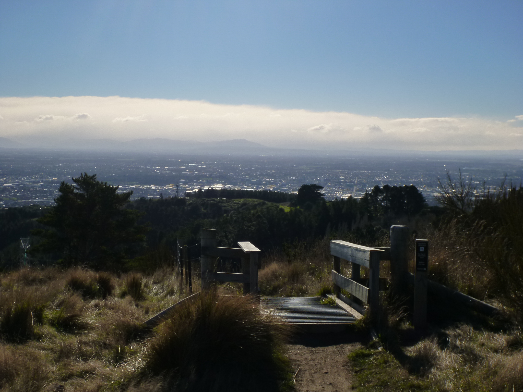
First of all, the Port Hills are just south of Christchurch. It’s nice because if you get on top of the hills you can see the whole city stretched out below you….

P1040617

…and if you turn around and look the other way, you can see all of Lyttleton Harbour and the rest of the Banks Peninsula in all its glory.

The area was formed by volcanic activity several bajilion years ago, (that’s precise scientific dating), which is why the harbour has the circular shape that it does. I learned that from a fellow student’s presentation.

INFO ALERT! The area was formed by volcanic activity several bajilion years ago, (that’s precise scientific dating), which is why the harbour has the basin shape that it does. I learned that from a fellow student’s presentation.

Several presentations took place on this trip, including mine. We each spent 10 minutes talking about a separate area/person/subject that had to do with our trip. I learned a lot, but that best part was that most of the time, we had this sort of view as we listened to the presentations.

P1040659

Most of the time. Sometimes we just took the sunshine when we could get it.

Most of the time. Sometimes we just took the sunshine when we could get it.

It was fun learning this way – it was relevant to what we were doing and where we were. Plus I didn’t have to pay attention for long: usually we’d be hiking, then stop for a 10-minute presentation, then keep on going again to do another one later. (rather than fitting 30 presentations on after the other back in the classroom, where you just start to zone out…)

I learnt how to navigate using a compass and a map, and I learnt from the presentations about the Maori in the Banks Peninsula area, the geology, its European history, and some plants and animals of the area.

P1040752

It was quite interesting also because it makes you realize how little you actually know about the places you visit. Even back at home in Alberta, I don’t really take the time to stop and wonder how this flower got its name, or how the land was formed, or what the history of the native people in that area. (Like, who would’ve known that beautiful, innocuous little Quail Island would’ve had such a dark and depressing history?)

Quail Island is in the top right corner of this photo

Quail Island is in the top right corner of this photo.

I’d been to the Port Hills before, but this was revisiting it again in a way that I definitely enjoyed. Despite having to prepare for the oral presentation.

P1040707

We also played a game of Mafia in the evening, (aka Werewolf) which gave us a good amount of laughter, making us forget we were here for school.

P1040680

Couscous supper

Couscous supper

Christchurch at night

Christchurch from above at night


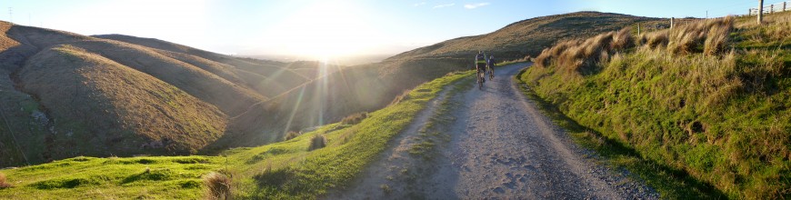
Craigieburn Wilderness Expedition

Two weeks later it was time to head out once more. (September 27/28/29th)

Again, I wasn’t very excited for this one, but again my expectations were matched and exceeded.

We sorted ourselves into groups of 3-6 people, and organized our tents and food that way. When we got to Craigieburn on Friday at 7pm, it was dark outside. Overcast and rainy too, so really. Dark.

The instructors dropped us off in our groups in several different spots along the road. They left us with our gear, our maps, compasses, the coordinates to our campsite, and the navigating knowledge from the previous trip. Then they left us, and we had to find our way to our unmarked campsite by ourselves.

The first thing we came across was forest, with a thick wall of underbrush. Even if it had been daylight we wouldn’t’ve been able to tell where we were supposed to go.

So we just pushed through the bush. Two people in our group led the way with maps and compasses, while Emmy and I kept count of how many steps we’d taken. That would tell us how many metres we’d gone and had left to go.

It took us an hour and a half to go 500m, because we took a sort of roundabout way by accident, but we made it. We found the clearing where we were supposed to be, and we set up our tents in the dark.

We arrived shortly after most other groups did, but one team took an extra two hours to get there. They had started from the farthest drop point though, so that’s understandable. They had almost been about to give up for the night, set up camp and find us in the morning, but our instructor found them. Another group, however, didn’t make it at all.

The next morning we woke up and split into three groups and, based on the knowledge we had, went out to find them. We found them within half an hour, and brought them back to camp to debrief.

The first lesson we learnt was: trust the compass. It turns out this group of three decided to follow the land, and what they thought the map said, and not the compass. They told us about crossing the stream (something we all did), and then walking until they found another stream (something no one else did) – that was running the wrong way. Turns out they had walked full circle and come across the same stream.

But in the end everything worked out – it wasn’t a huge area to begin with anyway.

The rest of the day was spent doing more navigation legs, learning how to triangulate, and listening to oral presentations from the people who hadn’t gone last weekend.

P1040762

Presentations

Triangulation

Triangulation

Me navigating

Me navigating

We also learned how to build emergency shelters/lean-to’s/bivouacs. We built them in pairs, then went around on a “home and garden show,” as our instructor called it, to take a look at them all. We then had a competition to see whose was the best.

The sales pitch for finalist #1

The sales pitch for finalist #1

The sales pitch for finalist #2

The sales pitch for finalist #2

#2 won, because it had a candle. (“Ambiance” they called it.)

That night it wasn’t raining, so we were able to eat supper in relative comfort. Some people played games and some went straight to bed.

The next morning, though, we woke up to snow.

P1060443 P1040785

I’m pretty sure this is the wettest trip I’ve been on in New Zealand so far. Every morning, Chris our instructor would show us a new game to get the blood flowing so that we would stay warm. (We played elves, trolls and wizards one day, choo-choo-train the next, and head shoulder knees and toes the last morning. Brings out the 5 year old in all of us.)

Then we did some more navigation, learning, and tramping.

We were headed for those cliffs to the right of Garrett

We were headed for those cliffs to the right of Garrett

Some sort of spider that's related to the tarantula

Some sort of spider that’s related to the tarantula

More triangulation

More triangulation

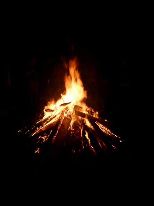
And finally, we learned how to build a fire when everything around you is wet, and how to disperse the ashes afterwards so as to leave no trace that you were ever there.

Thanks to Ellen White for the next 5 photos

Thanks to Ellen White for these next 5 photos

1374865_10151929038820540_1234174171_n

1378118_10151929038860540_1772339691_n

1382825_10151929038890540_646742230_n

fire

All in all, I was the wettest I’ve ever been, and the most tired and uncomfortable I’ve been on a tramp. (due to not feeling well and not sleeping, on top of the wet.) I’d never wanted to just get home more than I did that weekend.

But, I’m not lying to you when I say it really was a good two days. I learned so much, and I had quite a lot of fun. My instructor’s enthusiasm definitely helped all of us stay in a good mood, as did several pairs of dry socks. I would definitely do it again.

P1040820

Lake Tekapo and Mount Cook

Again we spent one night in Christchurch before setting out. If I remember right, we got fish and chips for supper, as is usual after a hiking trip. (I’ve been told that if there’s a typical NZ food, it’s fish n chips.) I can’t say that it’s healthy, but it tastes pretty good.

Monday morning we repacked our bags and headed out for Lake Tekapo. On the way out of town we stopped at the Cookie Factory, where you can get misfit cookies (broken or misformed, but otherwise fine) for cheap.

P1040137

I’ve heard Tekapo is a very touristy place, because it’s beautiful and because the weather is almost always nice. It took us 3 to 4 hours to get there, and when we got out of the car I realized that yup, it’s pretty much exactly as described. It actually put me in mind of Lake Louise in Banff.

P1040281
P1040299

This guy had an iphone, an ipad, a camcorder and a DSLR. Because just one scenery-capturing device isn’t enough, obviously

We saw a tourist who had an iphone, an ipad, a camcorder and a DSLR. Because just one scenery-capturing device isn’t enough, obviously.
(credit to Will Rynearson for the photo)

Just a short drive up a small mountain took us to the Mount John Observatory. This is owned by the University of Canterbury, but tourists can buy a short time of nightsky observing if they so wish. We did not wish, so we just went up there for the view. (at least not for that amount of money)

P1040201

P1040216

Credit to Will Rynearson for the photo

Credit to Will Rynearson for the photo
(Look! I’m the shortest person in the group! When&how did that happen?)

We stayed at Lake Tekapo for the sunset and until the stars came out, seeing as we had two photographers in the group. While we waited I gave a mini course on how to build an inukshuk. Everyone got an A+.

Credit to Andreas Blöschl for the photo

Credit to Andreas Blöschl for the photo (and the inukshuk!)

P1040289-Panorama

P1040172

SHEEP!  These are some lucky sheep...

SHEEP!
These are some lucky sheep…

Credit to Will Rynearson for the photo

Credit to Will Rynearson for the photo

We cooked supper in the parking lot that night, watching people come and go for a few hours. We got a little bit of attention for sitting on the ground in the middle of the parking lot, but that’s what you get for being too cheap to go find a restaurant.

At one point a lady drove up and helped us find Scorpio in the sky, as well as Venus and Saturn. Later we drove on towards Mount Cook village. We turned off the main road somewhere right before the airport to do some freedom camping once again.

Thanks to Will Rynearson and his wonderful camera for these two photos

Thanks to Will Rynearson and his wonderful camera for these two photos

1185669_10151830312296100_1425848894_n

P1040321

There were sheep turds everywhere, so choosing a spot wasn’t that difficult.

The next day, (Tuesday) we went to explore Mount Cook National Park. Mount Cook is the tallest mountain in New Zealand, which makes it quite an attraction. We didn’t get right up close, we weren’t able to from this side of the mountains. We took a hike up to Hooker Lake in the hopes that we’d be able to see a bit more, but unfortunately it was raining sideways at us and the clouds made it hard to see the tops of the mountains. But we did get to see some icebergs and glaciers.

P1040368

Then we had lunch, with another special guest wanting our food.

P1040334

Tasman Valley was a 5 minute drive away, so we headed there next. Surprisingly, there were no clouds at all and the weather was beautiful. Here again we got to see some icebergs, and the tip of Mount Cook was also visible.

The two photographers

The two photographers

The tip of Mount Cook can be seen to the right, with the wind blowing snow off the top

The tip of Mount Cook can be seen to the right, with the wind blowing snow off the top

P1040459-Panorama

View of Tasman Lake with Mount Cook to the left.

That night we did some more stargazing and freedom camping, although someone had to sleep in the car because our second tent turned out to not be as good as we’d thought. I hear it was quite comfy though, and warm too. (the wind was quite strong that night)

Wednesday we drove home, stopping in Twizel along the way to say hi to Gabe on his fishing adventure. Our map also informed us that the area used to film the Plains of Rohan in the Lord of the Rings was nearby, so we took a detour to take a peek at that as well.

The Plains of Rohan

The Plains of Rohan

It wasn’t the most exciting place in the world… but there you have it. Those are the plains of Rohan.

We got back to Christchurch in the early evening after a long but scenic drive. The rest of the week was for laundry and schoolwork. And that was our term break.

We’re halfway through the school semester!

The First Week

I arrived in Christchurch on the 28th of June after a 26-hour flight. The University of Canterbury has a free pickup service for international students, so there was a taxi driver waiting for me when I got to the airport.

My first confusion/culture shock/whatever-you-wanna-call-it moment happened when I went for the passenger door, and realized that there was a steering wheel there. Oops. Right. They drive on the wrong side of the road.

My apartment is quite nice, at least for what I was expecting. I have my own room, fluffy blankets and pillows, and I share a kitchen and living room with four other people. We have no oven, but the microwave can act as one if I absolutely need to use an oven (and I probably won’t).

Image

Image

I’ve met 3 of my flatmates so far. Two of them are identical twins named Pat and Mike. They’re Kiwis from the north island, and I think I can finally tell them apart after all this time. They helped me out quite a bit at first, telling me where to go to buy a cell phone, how to buy a bus pass, etc. My other flatmate arrived a little bit after me, her name is Kristina and she’s from Austria. I have come to learn that Austrians speak German – but Germans are to Austrians as Americans are to Canadians. As are Aussies to Kiwis. Please take note 😉

All my flatmates are, I’m happy to say, perfectly okay with me singing as I do dishes. (and anything else, really)

The international services at the uni (see me using kiwi slang already >.<) organized a few events for the international students right at the start, so that everyone could get together and meet each other. The first such event was a bonfire with free food, music, and poi dancing.

Image

Photo courtesy of Jürgen Brandstetter

Photo courtesy of Sheila Wesa

Photo courtesy of Sheila Wesa

The second event was called “Maori Experience,” where they cooked a hangi for us. A hangi is (was) the Maori way of cooking. Since they had no ovens, they would dig a hole, heat up a bunch of rocks, and bury the food with the hot rocks underneath. Several hours later the food would be ready and they would dig it back up again. So they did that for us, and we got to experience a Maori-style meal.

Hangi

Afterwards, the Maori group danced the Haka for us, which was a sight to see.

If you don’t know what the Haka is, just read the first paragraph here: http://en.wikipedia.org/wiki/Haka

It was pretty impressive. I would be scared if I was the opposing group.

Those two events were pretty much how I got to meet people. I’ve noticed that there are a lot of Americans studying abroad here. They are by far the largest group of international students. Some of the other nationalities I’ve met are: French, German, Malaysian, Welsh, Danish, Chinese, and a few countries I can’t remember the names of. I’ve also met a few other Canadians, all from UBC.

The first hiking adventure I got was the last Sunday before school started. A few other international students and I decided to go to the Port Hills to do some tramping (kiwi slang for hiking). Christchurch is generally a very flat city, pretty much like Edmonton. Actually I think Edmonton has more hills than the Canterbury plains do, just because of the river. But, Christchurch is surrounded by mountains. The Port Hills, for example, are just a half-hour busride from the middle of town.

We took the bus towards these hills, our destination being an area called Victoria Park. After a short hike we came to the top of a mountain and we could see all of Christchurch laid out before us, with the Southern Alps to the North and the ocean to the East.

P1010943

When we were at the absolute top and looked South, we could see Lyttelton Harbour.

Photo courtesy of Will Rynearson

Photo courtesy of Will Rynearson

Group photo! From left to right, the people in this photo are Will (USA), Heiko (Germany), moi, Andy (Austria), Gabe (USA), Carmen (Germany), and my flatmate Kristina (Austria).

After tramping the whole day, we decided to do a group dinner. We decided on pizza, since it’s pretty easy. Most of the group also live in the Ilam Apartments, so we had to go to Heiko’s place off campus since he has an oven.

The pizza was delicious, but kinda sweet. We all wondered why, until afterwards when we were cleaning up and we realized that we had put ketchup on our pizza in lieu of tomato sauce…

I mean, we’d all been told that kiwis call ketchup “tomato sauce,” and that it can be confusing, but none of us even thought about it when someone put a can of “tomato sauce” into the cart.

Who puts ketchup in cans anyway?

Well it doesn’t matter, it actually tasted pretty good, and we ate 5 pizzas among 6 people.

Photo courtesy of Carmen Widera

Photo courtesy of Carmen Widera

This being my first adventure, and what I came to New Zealand for, I was a super happy camper after that trip.