Angelus Hut

So… I’ve gotten a little behind on the whole blogging thing. But I can be excused: I was on a road trip for two and a half weeks, most of the time in places that don’t have cell phone service and you have to pay cash for the hostel you stay in. Now I’m back in Christchurch, though, so it’s time for some catching up. Prepare yourself, because some seriously cool stuff (and some scary stuff) happened while I was gone. Let’s start with almost a month ago, way back while I was still in school.

It was the last weekend before I would be completely done. One more weekend before freedom set in – after that I would have three whole months before I would be back studying in Edmonton once again.

So on Friday afternoon, five of us drove to Nelson Lakes National Park and did some freedom camping beside lake Rotoiti. (freedom camping = camping wherever, and not paying for it!)

Us freedom camping, in kiwi country

Us freedom camping, in kiwi country

It happened to be Andy’s birthday that day, so Heiko and Will had secretly bought him a cake and brought it along. We sat on the dock at the edge of the lake in the dark, in the candlelight with a bottle of wine and enjoyed a couscous & beans supper, followed by birthday cake. It turned out though that Eesh had also secretly bought him a cake, and so we had two chocolate cakes between the five of us.

Long exposure picture of us preparing supper, with our headlights on. I was just staring into the lake

Long exposure picture of us preparing supper, with our headlights on. I was just staring into the lake. (thanks to Will Rynearson for the photo)

In this picture I’m looking into the water at the eels that were at least a metre long. In the dark you couldn’t tell where the water ended and the air began, so it looked like the eels were gliding through the air and that they might just fly right at you and eat your finger. It was pretty cool.


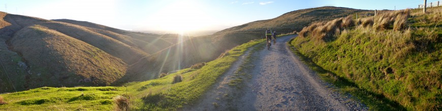
The next day we began our hike, and I was reminded just how out of shape I had gotten in the past two weeks. (Cramming all of your semester-long project into just two weeks is not a good idea for more reasons than just academics.) I was also reminded, however, of how beautiful New Zealand can be.

P1040887

P1040919-Panorama

P1040952-Panorama

Seriously, how can New Zealand be so beautiful, everywhere? What a country.

For the better part of that day, we followed the trail along the ridge of a mountain towards our destination. We came across snow and mud and scree slopes.

P1040978

I hate scree slopes. So much. Looks cool though.

I hate scree slopes. So much. Looks cool though.
(thanks to Will Rynearson for the photo)

Having a friendly snowball fight on the top of the mountain. Seriously, too friendly. It was like the cold war. Neither would throw the first snowball.

Having a friendly snowball fight on the top of the mountain. Seriously, too friendly. It was like the cold war. Neither would throw the first snowball.

IMG_5716_1_small

(thanks to Andreas Blöschl for the photo)

This ^ picture has a kea in the forefront. The kea is the only mountain parrot in the world, and they’re endangered. I think I’ve talked about them before, but you can go here for more info about them if you’re curious:

Click on me!

This kea kept following us. They’re naturally very curious creatures, keas, and this one seemed very interested in us for about an hour or so. We got to calling him Kevin for some reason, and he then became known as Kevin the Kea.

Kevin flying -  what beautiful colours (thanks to Will Rynearson for the photo)

Kevin flying – what beautiful colours
(thanks to Will Rynearson for the photo)

Eesh with Kevin

Eesh with Kevin

Kevin sitting there, looking pretty

Kevin sitting there, looking pretty

Kevin the superstar

Kevin the superstar

We got to our destination 6 hours later. Here’s a picture of the final stretch, with the hut in the background.

P1050005

Although you might not be able to tell it, there is a frozen lake there. I’m sure in the summertime this would be a crystal clear blue/green lake, and stunningly beautiful. (actually, let’s just google it) It’s beautiful now too though. (it’s early spring here)

The hut from the inside. Basically a mansion, for us trampers. I think this trail gets pretty busy in the summer though: there are X bunks in this hut and you actually have to book one or else you won’t get a spot.

The hut from the inside. Basically a mansion, for us trampers. I think this trail gets pretty busy in the summer though: there are X bunks in this hut and you actually have to book one or else you won’t get a spot.

That tramp was a little hard for me, mostly because I’d been sitting doing nothing for the past couple of weeks. I was so focused on getting there that, although I saw it and was taking pictures of it, it didn’t hit me just how beautiful the scenery was. It wasn’t until the next day as we descended that I had the jaw-dropping experience that brings me back to the mountains every time.

P1050019

Also, this side of the ridge looked a lot less like the rocky mountains I’m used to – so it was more shocking.

P1050027

Breathtaking is what I would call it.

P1050036-Panorama

P1050062

P1050065-Panorama

P1050088

That day was also a long one. I decided to bring out my ipod and listen to music on the trail.

P1050091

On the drive home we told riddles, which I decidedly suck at solving. But it was fun.


Then I had a week to finish my last two papers, and we were off again – this time for two and a half weeks.

New Zealand Place Names

are weird.

P1050648

For example.

First of all, I gotta say I love the range of websites that are available to Kiwis in terms of tramping. The MetService, the Avalanche Centre, NZ Walks, DOC Maps, and the Topomap are all fantastic examples.

Maybe it’s just because I don’t do as much tramping in Canada, but I haven’t seen any sites that had so much information so easily accessible. I wish we had that though. It’s very helpful.

But anyway.

In tramping around the country you tend to start to notice things like names of mountains, lakes, campsites, etc. I’ve noticed a few strange ones, either by looking at the map or by walking/driving past a sign. I’d like to share; some people have said New Zealand has the worst names, but I think it’s great. So here’s the list.

(I’ll add names as I find new ones, but this is as good a start as any.)

Mountain names
Sugarloaf Mountain
Mount Misery
Mount Horrible
Thesis Peak (spurring many jokes from master’s and doctorate students who enjoy tramping)
Mount Hopeless
Purple Hill

Looking out at Purple Hill

Looking out at Purple Hill

Mount Awful
Mount Alarm
Taumatawhakatangihangakoauauotamateapokaiwhenuakitanatahu
–    Yes that’s a name. Although it’s more of a hill than a mountain. (It’s the longest place name in English speaking country, 2nd longest in the world apparently. But shortened to “Taumata” for ease of pronunciation. It translates roughly from the Maori language as “The summit where Tamatea, the man with the big knees, the climber of mountains, the land-swallower who travelled about, played his nose flute to his loved one”)

Not mountains
Cape Foulwind
Mosquito Bay
Starvation Point
Nuns Veil
Faerie Queen
Stinking Stream
Death’s Corner

Buildings
Cannibal Gorge Hut

Cannibal Gorge Hut

Why Not Café
Elsewhere Pub

Elsewhere

Tramping for University Credit

I’m currently taking a class called Land Journey and Ethics, in which we are required to think about the way we treat the environment, and how we interact with nature. Although this class has nothing to do with my Linguistics degree, I thought it was quite appropriate considering the amount of tramping I intended to do in New Zealand. The main reason I took it was for the two field trips that would take place during the second term.

This blogpost is all about those two field trips – camping for class credit.


Port Hills Expedition

On the 14th and 15th, our first field trip took place. For me, a 30 minute bus ride away from uni doesn’t really seem much like ‘wilderness,’ and so I wasn’t particularly looking forward to this trip. But the weekend actually ended up being quite fun.

First of all, the Port Hills are just south of Christchurch. It’s nice because if you get on top of the hills you can see the whole city stretched out below you….

P1040617

…and if you turn around and look the other way, you can see all of Lyttleton Harbour and the rest of the Banks Peninsula in all its glory.

The area was formed by volcanic activity several bajilion years ago, (that’s precise scientific dating), which is why the harbour has the circular shape that it does. I learned that from a fellow student’s presentation.

INFO ALERT! The area was formed by volcanic activity several bajilion years ago, (that’s precise scientific dating), which is why the harbour has the basin shape that it does. I learned that from a fellow student’s presentation.

Several presentations took place on this trip, including mine. We each spent 10 minutes talking about a separate area/person/subject that had to do with our trip. I learned a lot, but that best part was that most of the time, we had this sort of view as we listened to the presentations.

P1040659

Most of the time. Sometimes we just took the sunshine when we could get it.

Most of the time. Sometimes we just took the sunshine when we could get it.

It was fun learning this way – it was relevant to what we were doing and where we were. Plus I didn’t have to pay attention for long: usually we’d be hiking, then stop for a 10-minute presentation, then keep on going again to do another one later. (rather than fitting 30 presentations on after the other back in the classroom, where you just start to zone out…)

I learnt how to navigate using a compass and a map, and I learnt from the presentations about the Maori in the Banks Peninsula area, the geology, its European history, and some plants and animals of the area.

P1040752

It was quite interesting also because it makes you realize how little you actually know about the places you visit. Even back at home in Alberta, I don’t really take the time to stop and wonder how this flower got its name, or how the land was formed, or what the history of the native people in that area. (Like, who would’ve known that beautiful, innocuous little Quail Island would’ve had such a dark and depressing history?)

Quail Island is in the top right corner of this photo

Quail Island is in the top right corner of this photo.

I’d been to the Port Hills before, but this was revisiting it again in a way that I definitely enjoyed. Despite having to prepare for the oral presentation.

P1040707

We also played a game of Mafia in the evening, (aka Werewolf) which gave us a good amount of laughter, making us forget we were here for school.

P1040680

Couscous supper

Couscous supper

Christchurch at night

Christchurch from above at night


Craigieburn Wilderness Expedition

Two weeks later it was time to head out once more. (September 27/28/29th)

Again, I wasn’t very excited for this one, but again my expectations were matched and exceeded.

We sorted ourselves into groups of 3-6 people, and organized our tents and food that way. When we got to Craigieburn on Friday at 7pm, it was dark outside. Overcast and rainy too, so really. Dark.

The instructors dropped us off in our groups in several different spots along the road. They left us with our gear, our maps, compasses, the coordinates to our campsite, and the navigating knowledge from the previous trip. Then they left us, and we had to find our way to our unmarked campsite by ourselves.

The first thing we came across was forest, with a thick wall of underbrush. Even if it had been daylight we wouldn’t’ve been able to tell where we were supposed to go.

So we just pushed through the bush. Two people in our group led the way with maps and compasses, while Emmy and I kept count of how many steps we’d taken. That would tell us how many metres we’d gone and had left to go.

It took us an hour and a half to go 500m, because we took a sort of roundabout way by accident, but we made it. We found the clearing where we were supposed to be, and we set up our tents in the dark.

We arrived shortly after most other groups did, but one team took an extra two hours to get there. They had started from the farthest drop point though, so that’s understandable. They had almost been about to give up for the night, set up camp and find us in the morning, but our instructor found them. Another group, however, didn’t make it at all.

The next morning we woke up and split into three groups and, based on the knowledge we had, went out to find them. We found them within half an hour, and brought them back to camp to debrief.

The first lesson we learnt was: trust the compass. It turns out this group of three decided to follow the land, and what they thought the map said, and not the compass. They told us about crossing the stream (something we all did), and then walking until they found another stream (something no one else did) – that was running the wrong way. Turns out they had walked full circle and come across the same stream.

But in the end everything worked out – it wasn’t a huge area to begin with anyway.

The rest of the day was spent doing more navigation legs, learning how to triangulate, and listening to oral presentations from the people who hadn’t gone last weekend.

P1040762

Presentations

Triangulation

Triangulation

Me navigating

Me navigating

We also learned how to build emergency shelters/lean-to’s/bivouacs. We built them in pairs, then went around on a “home and garden show,” as our instructor called it, to take a look at them all. We then had a competition to see whose was the best.

The sales pitch for finalist #1

The sales pitch for finalist #1

The sales pitch for finalist #2

The sales pitch for finalist #2

#2 won, because it had a candle. (“Ambiance” they called it.)

That night it wasn’t raining, so we were able to eat supper in relative comfort. Some people played games and some went straight to bed.

The next morning, though, we woke up to snow.

P1060443 P1040785

I’m pretty sure this is the wettest trip I’ve been on in New Zealand so far. Every morning, Chris our instructor would show us a new game to get the blood flowing so that we would stay warm. (We played elves, trolls and wizards one day, choo-choo-train the next, and head shoulder knees and toes the last morning. Brings out the 5 year old in all of us.)

Then we did some more navigation, learning, and tramping.

We were headed for those cliffs to the right of Garrett

We were headed for those cliffs to the right of Garrett

Some sort of spider that's related to the tarantula

Some sort of spider that’s related to the tarantula

More triangulation

More triangulation

And finally, we learned how to build a fire when everything around you is wet, and how to disperse the ashes afterwards so as to leave no trace that you were ever there.

Thanks to Ellen White for the next 5 photos

Thanks to Ellen White for these next 5 photos

1374865_10151929038820540_1234174171_n

1378118_10151929038860540_1772339691_n

1382825_10151929038890540_646742230_n

fire

All in all, I was the wettest I’ve ever been, and the most tired and uncomfortable I’ve been on a tramp. (due to not feeling well and not sleeping, on top of the wet.) I’d never wanted to just get home more than I did that weekend.

But, I’m not lying to you when I say it really was a good two days. I learned so much, and I had quite a lot of fun. My instructor’s enthusiasm definitely helped all of us stay in a good mood, as did several pairs of dry socks. I would definitely do it again.

P1040820

Lake Tekapo and Mount Cook

Again we spent one night in Christchurch before setting out. If I remember right, we got fish and chips for supper, as is usual after a hiking trip. (I’ve been told that if there’s a typical NZ food, it’s fish n chips.) I can’t say that it’s healthy, but it tastes pretty good.

Monday morning we repacked our bags and headed out for Lake Tekapo. On the way out of town we stopped at the Cookie Factory, where you can get misfit cookies (broken or misformed, but otherwise fine) for cheap.

P1040137

I’ve heard Tekapo is a very touristy place, because it’s beautiful and because the weather is almost always nice. It took us 3 to 4 hours to get there, and when we got out of the car I realized that yup, it’s pretty much exactly as described. It actually put me in mind of Lake Louise in Banff.

P1040281
P1040299

This guy had an iphone, an ipad, a camcorder and a DSLR. Because just one scenery-capturing device isn’t enough, obviously

We saw a tourist who had an iphone, an ipad, a camcorder and a DSLR. Because just one scenery-capturing device isn’t enough, obviously.
(credit to Will Rynearson for the photo)

Just a short drive up a small mountain took us to the Mount John Observatory. This is owned by the University of Canterbury, but tourists can buy a short time of nightsky observing if they so wish. We did not wish, so we just went up there for the view. (at least not for that amount of money)

P1040201

P1040216

Credit to Will Rynearson for the photo

Credit to Will Rynearson for the photo
(Look! I’m the shortest person in the group! When&how did that happen?)

We stayed at Lake Tekapo for the sunset and until the stars came out, seeing as we had two photographers in the group. While we waited I gave a mini course on how to build an inukshuk. Everyone got an A+.

Credit to Andreas Blöschl for the photo

Credit to Andreas Blöschl for the photo (and the inukshuk!)

P1040289-Panorama

P1040172

SHEEP!  These are some lucky sheep...

SHEEP!
These are some lucky sheep…

Credit to Will Rynearson for the photo

Credit to Will Rynearson for the photo

We cooked supper in the parking lot that night, watching people come and go for a few hours. We got a little bit of attention for sitting on the ground in the middle of the parking lot, but that’s what you get for being too cheap to go find a restaurant.

At one point a lady drove up and helped us find Scorpio in the sky, as well as Venus and Saturn. Later we drove on towards Mount Cook village. We turned off the main road somewhere right before the airport to do some freedom camping once again.

Thanks to Will Rynearson and his wonderful camera for these two photos

Thanks to Will Rynearson and his wonderful camera for these two photos

1185669_10151830312296100_1425848894_n

P1040321

There were sheep turds everywhere, so choosing a spot wasn’t that difficult.

The next day, (Tuesday) we went to explore Mount Cook National Park. Mount Cook is the tallest mountain in New Zealand, which makes it quite an attraction. We didn’t get right up close, we weren’t able to from this side of the mountains. We took a hike up to Hooker Lake in the hopes that we’d be able to see a bit more, but unfortunately it was raining sideways at us and the clouds made it hard to see the tops of the mountains. But we did get to see some icebergs and glaciers.

P1040368

Then we had lunch, with another special guest wanting our food.

P1040334

Tasman Valley was a 5 minute drive away, so we headed there next. Surprisingly, there were no clouds at all and the weather was beautiful. Here again we got to see some icebergs, and the tip of Mount Cook was also visible.

The two photographers

The two photographers

The tip of Mount Cook can be seen to the right, with the wind blowing snow off the top

The tip of Mount Cook can be seen to the right, with the wind blowing snow off the top

P1040459-Panorama

View of Tasman Lake with Mount Cook to the left.

That night we did some more stargazing and freedom camping, although someone had to sleep in the car because our second tent turned out to not be as good as we’d thought. I hear it was quite comfy though, and warm too. (the wind was quite strong that night)

Wednesday we drove home, stopping in Twizel along the way to say hi to Gabe on his fishing adventure. Our map also informed us that the area used to film the Plains of Rohan in the Lord of the Rings was nearby, so we took a detour to take a peek at that as well.

The Plains of Rohan

The Plains of Rohan

It wasn’t the most exciting place in the world… but there you have it. Those are the plains of Rohan.

We got back to Christchurch in the early evening after a long but scenic drive. The rest of the week was for laundry and schoolwork. And that was our term break.

We’re halfway through the school semester!

Nelson, Nelson Lakes and Punakaiki

After finishing the Abel Tasman track we drove down to Nelson (one of the most scenic drives I’ve ever taken) and got a motel for the night. The place we stayed at had a winter special going on, so we got a good room (it was more like a suite, with a kitchen, living room and everything) for a good price. Once we’d split the cost, it was maybe the same as a hostel would have charged. ($30/night)

There we all showered and enjoyed sleeping in beds once again.

P1030862b

The after photo

Well I mean, the couch was comfy too.

Not only did the motel have good prices, they also had a continental breakfast. The next morning we were brought crepes with bananas, whipped cream and syrup. Unfortunately I learnt that people here like to say “maple syrup” when they simply mean “syrup.” (I got all excited when I heard him say he’d bring us maple syrup with our crepes, before one of my American friends told me that it was probably going to be just normal syrup. Even in the States apparently people don’t care to distinguish the two. And sure enough, the next morning they definitely brought us just plain old syrup. (I know, it’s disappointing. The world needs to get their food labels straight.))

Friday

Friday was spent exploring the city. Nelson is quite a nice little town. The area is comparable to Victoria BC, with wineries close by and beautiful flowering trees all over the place. The town even has a cathedral.

P1030865

Photo credit: Will Rynearson

Photo credit: Will Rynearson

We went on a 15 minute tramp that day as well, which we decided to count as being our 7th day in a row of hiking. Because why not. (If I work up a sweat, it counts, right?) The destination was the Centre of New Zealand.

P1030900

The centre of New Zealand is conveniently located on the top of a hill with a beautiful view of Nelson down below. (While not actually being the exact physical centre of New Zealand, this point has been used by surveyors for quite some time as being near enough.)

P1030908
P1030906-Panorama
P1030930

Photo credit: Andreas Blöschl

Photo credit: Andreas Blöschl

Later on we went shopping for groceries for the next few days. I bought myself some manuka honey. It’s pretty expensive stuff, but apparently it has some really good health benefits. It tastes a little different than regular honey, and is unique to New Zealand. (made from Manuka trees, which are only found in NZ)
I had to buy some. YOLINZO (you only live in New Zealand once)

$13 for a small container like this

$13 for a small container like this

After that we went to enjoy the sunset at the beach before heading back to our motel and cooking ourselves some pizza.

P1030935
P1030978

Photo credit: Andreas Blöschl

Photo credit: Andreas Blöschl

We spent another night in the motel before heading down the West Coast and back to Christchurch.

Saturday

Saturday was mostly spent driving. Gabe took the bus back to Christchurch from Nelson so that he could spend the rest of the school break fishing, which made our drive a little more comfortable with only 4 people instead of 5. As we passed through Nelson Lakes National Park we stopped at Lake Rotoiti for a 4 hour tramp up a mountain. (for those of you who like maps, http://www.topomap.co.nz/NZTopoMap/nz38460/Parachute%20Rocks/Tasman)

Once again, the view was beautiful. New Zealand never fails to amaze.

P1040005
P1040023
P1040017
P1040009-Panorama

Photo credit: Will Rynearson

Photo credit: Will Rynearson

Photo credit: Will Rynearson

Photo credit: Will Rynearson

That night we drove until it got dark. We were aiming for a campground that was listed on our map, but when we got there it was closed. Instead we decided to do some freedom camping. Freedom camping = you can camp for free wherever you want, so long as it’s not on private property or in a national park, and it’s 200m away from the road or anything man-made.

We ended up camping in punakaiki national park, but it wasn’t the main entrance to the park – we hoped that no one would come and check that we were there. There were signs on the ground that others had done the same before us. The only thing I really remember from this night was laying outside on our mats, in our sleeping bags, looking up at the stars as we waited for the pasta to cook. I’m still awed by the night sky here in New Zealand. And Will also taught us once again how to find South by using the southern cross.

Sunday

Sunday we packed up quickly because of all the sand flies. (I still don’t think they’re as bad here as the mosquitoes in rural Alberta, but they are bad.)

We drove down the West Coast, stopped at the Pancake Rocks, and then continued our journey on to Christchurch.

P1040103

Scientists are not sure how exactly the pancake rocks formed – but it has something to do with thousands of years, and ocean.

P1040123

The West Coast is beautiful


We went through Arthur’s pass to get back home. Arthur’s Pass is a drive which is becoming quite familiar.

P1040128

We stopped in Arthur’s pass to eat lunch, and were bombarded by keas. A kea is an alpine parrot, the only mountain parrot in the world, and they’re endangered. They’re hard to find anywhere else, but I’ve never failed to see one going through Arthur’s Pass. Being very curious birds, they’ll always come out and say hi, and they’re very smart – especially when it comes to getting food. They’re also kind of annoying. If you let them, they’ll peck at the rubber parts on your car, or drink the rest of your coffee, or steal small items of clothing. We brought out our lunch and immediately attracted the attention of several keas.

P1040130
P1040133

Photo credit: Andreas Blöschl

Photo credit: Andreas Blöschl

This kea was just testing the waters – he didn’t actually hop up on my arm.

Abel Tasman Coast Track

Monday

The next day we left for Abel Tasman. New Zealand has 9 Great Walks (world-renowned tramps that are several days long, through beautiful scenery), and Abel Tasman is one of them.

The track is 54km long and takes 3-5 days to complete. We decided it would be a great backpacking trip for our term break. So the 5 of us that bought a car (Will, Gabe, Kristina, Andi and I) squished ourselves and our backpacks into the red Honda Integra and set off in the early morning.

1234388_10201899268188332_2115763239_n

Credit to Gabe Park for the photo

After 7 hours, we got to our destination. We paid our camping fees at the information centre ($15/person/night), along with a ticket for a watertaxi. (Since the whole thing is a one-way track, you need to take a watertaxi back to your car at the starting point. We decided that one person would take the watertaxi and then come pick the rest of us up, in order to save $45 each.)

P1030631

The before picture

It was around 3pm when we started hiking. We went 12km and ended up getting to our first campsite just after dark. We set up our tents, cooked ourselves some pasta and then sat around the fire talking until it was time for bed. It was the first time I’d ever fallen asleep to the sound of waves crashing against the shore.

Tuesday

Tuesday was rainy. That’s about all you need to know about Tuesday. It wasn’t particularly fun; it turns out my raincoat wasn’t quite as waterproof as I thought it was, after hours of the rain working down the waterproof covering. We walked for 15km before finally getting to our campsite, where we were glad to see a cooking shelter waiting for us.

P1030731

P1030710

For the most part the rain had stopped by the time we had set up our tents. I don’t know what possessed me at that particular moment, but I felt the need to go for a run at that point. We were situated right next to a beautiful beach, and so I went for a short jog alongside the waves.

P1030738-Panorama

That night we made macaroni and cheese. (Real macaroni and cheese – with melted cheese, onions, garlic, peas, and sausage.) I ate ‘til I was stuffed, and then I remember commenting that I’m pretty sure I eat better on tramps than I do at home.

We sat around talking again that night, inside the cooking shelter, while drinking tea and sharing chocolate. Seeing as we’ve made friends with quite a few Germans and Austrians, Will and I are determined to learn a bit of German while we’re here. (a true Kiwi experience, I know) So we learned a few words from Andi and Kristina after supper, as well as a few sentences. I can now officially speak a little bit of German. (Ich war ein kleiner grüner Frosch)

Later that night we had a visitor; a possum came by to see if we would share any food. We didn’t of course, but he came by several times just in case. Gabe caught of a photo of him from behind as he was running away:

1233525_10201899277868574_1303251990_n

We left our backpacks in the shelter that night, so they wouldn’t get more soaked than they already were. We made sure to store all our food safely deep inside our backpacks where the possum wouldn’t be able to get at it.

Wednesday

We woke up to a mess in the cooking shelter. It turns out Kristina had forgotten some of her food in the “brain” of her backpack (the top part that can flip open). So the possum had opened the zipper, eaten all the granola bars and apples that had been there, and left wrappers and turds everywhere. It was quite a mess.

And now I understand why no one likes possums very much. 😉

(In fact, the government of New Zealand has this to say about it: )

P1040326

Click on photo to enlarge

That day we had two tidal crossings along our route. The Abel Tasman Coastal Track follows the shoreline quite closely for it’s full 54km, so there are a few occasions when the trail crosses an estuary. A tidal crossing is where you have to wait for low tide to be able to continue across the estuary. Even at low tide the water can come pretty high, so crossing at high tide would be impossible. But we’d learnt the tidal times at the info centre and we’d planned for it. Like any other tramp so far, we knew we weren’t getting out of this with dry ankles.

The water came up to the middle of my thighs at this crossing. (Credit to Andreas Blöschl for the photo)

The water came up to the middle of my thighs at this crossing.
(Credit to Andreas Blöschl for the photo)

Credit to Andreas Blöschl for the photograph :)

Credit to Andreas Blöschl for the photograph 🙂

That night we played cards (and drank tea and ate chocolate as usual of course) underneath the roof of another shelter, as it rained outside. We had another visitor that night: a Weka bird came by several times to check for any food. We weren’t too worried, because all the food was stowed away, until at one point when the bird stole Gabe’s socks that he had left out to dry. Gabe chased him down and got his socks back, but after that we had to keep an eye out for the rest of our stuff.

P1030775

Thursday

At this point, we were another 17km from the end of the track. Originally we had thought that we’d planned to finish the whole thing, but upon reaching our campsite on Wednesday, and seeing the name of the campsite, we realized that the lady who had booked our watertaxi had booked it for this campsite. So we had inadvertently arranged to be picked up at the second last stop. This turned out to be a good thing, as we were all really glad to not have an extra 17km to do that day; it was our 5th day in a row of tramping and we were getting pretty tired.

But I felt rather disappointed when I found out I wouldn’t be actually hiking the whole thing, and Andi felt the same. So we worked out a plan: the next day, Will would take the watertaxi back to get our car while Gabe and Kristina waited. Meanwhile Andi and I, leaving most of our gear behind with those two, would head out to finish the rest of the track. Will would pick up Gabe and Kristina there, and then continue on to pick up Andi and I at the finish line.

Credit to Will Rynearson for the photo

Credit to Will Rynearson for the photo

We all enjoyed our own little adventures that day. The weather had turned nice, the first sunny day since we got there, and it was a blessing. For me, it was a great way to end the trip. Since we didn’t have our heavy packs and the trail was well groomed, Andi and I decided to do a little bit of running. (Well, he had a backpack – we fit both of our day stuff into one pack. It still wasn’t as heavy, but water, cameras, and food still weigh a lot. Props to him for being able to run with a backpack on, and letting me go without.) We ended up running every time the trail went downhill, and walking all the uphill bits. I would say we ran at least a third of our journey that day, and it ended up being about 20km total. (I said it was 17 earlier, but we got lost somewhere along the way and took a 3km loop track by accident, before getting back on track.)

P1030798

That’s probably the most fun I’ve had on a trail so far. It was just the right amount of work for my fitness level so it was a good workout, and trail running is surprisingly fun. The sights were gorgeous too. We passed golden beaches and walked beside the waves as they crashed onto the sand, saw some seals and endangered birds, and got to see the rainforest in the beautiful sunlight. It was a great day.

P1030813

Doing a little photography while we waited for the others

All the little holes in the sand where the crabs hide

All the little holes in the sand where the crabs hide

Our car coming to pick us up. Credit to Andreas Blöschl for the photo again.

Our car coming to pick us up.
Credit to Andreas Blöschl for the photo again.

Bushball

So last time I wrote I talked to you guys about my onesie. The real reason I bought it was not just too look cool and feel snuggly warm, it was so I could wear it to Bushball.

Bushball is pretty much exactly what it sounds like: a ball in the bushes. (ball as in party. But we had a ball, if you know what I mean 😉 ) The trip consisted of a 3 hour tramp into the wilderness, where we set up our tents, donned our onesies (or costumes), laid out a potluck, mixed the alcoholic beverages, opened the keg, and had a good time.

(yes, there was a keg. It was a 25L one, and somebody went without a backpack in order to carry it in)

P1030538

On Saturday morning we got together in the main parking lot as usual, where 30 or so people from the tramping club crammed ourselves into vans and our backpacks into trailers behind us. We drove into Lewis Pass this time, rather than our usual destination in Arthur’s Pass. It was only about a 3 hour drive.

The hike in was only 7km, but it rained off and on and there was a bit of elevation gain here and there. I’ve come to expect rain from New Zealand… if you come here to tramp you have to know that there is no staying dry, ever. If you’re lucky and it doesn’t rain on you, there will most certainly to be a river to cross at one point. But so long as you are prepared with extra dry clothes, it really doesn’t matter. The landscape is beautiful all the same.

P1030547

There was a hut at our destination… which is good, because it did quite a bit of raining. So we set up the party inside the hut (we just couldn’t sleep in it because we hadn’t paid) and we set up our tents outside for sleeping.

P1030566

There’s the keg. The hut in the background is called ‘Cannibal Gorge Hut’

The whole thing was well organized by Johannes: everyone had a job to do. You could write up a trip report and take photos, help clean up afterwards, help haul the keg in, mix alcohol, buy the alcohol, etc. And everyone also had to bring something for the potluck: I brought dessert. The potluck was a delicious meal, despite being limited to tramping food.

Some Kaiserschmarrn made & photographed by Andreas Blöschl

Some Kaiserschmarrn made & photographed by Andreas Blöschl

The theme for the party was either what you want to be when you grow, or onesie. I chose onesie, and I roamed the hut as a bear the whole night. There was definitely a range of other fuzzy animals to keep me company.

Photo courtesy of Andreas Blöschl

Photo courtesy of Andreas Blöschl

Carmen wanted to be a princess when she grew up

Carmen wanted to be a princess when she grew up

And then there was a dance party, somehow. O.o

P1030580

Photo courtesy of Andreas Blöschl

Photo courtesy of Andreas Blöschl

Anyway, it was a lot of fun. I ended up falling asleep in the tent around 1am, and the next morning we woke up around 11 to make our way back out of the woods.

P1030597


The next adventure? Tackling Abel Tasman, one of New Zealand’s Nine Great Walks.

Onesies, Cars, and Farmer’s Markets…

This weekend wasn’t quite as exciting as past weekends have been. I had an exam to study for, as well as some homework to catch up on, (and a room to clean) so I stayed home. It wasn’t uneventful though.
This week as it went by:

Friday

Friday was movie night. Michael (from Austria) happens to own the extended version of all three Lord of the Rings movies, and my roommate Kristina hasn’t seen them yet (*gasp.* I know, right?). So we watched part one on Friday. Popcorn and chips for all!

Saturday

Saturday I visited the Farmer’s Market, which I haven’t had a chance to do yet. There was lots of good food: bacon & egg sandwiches, Japanese pizzas, cake, hot chocolate… all for breakfast. (Any meal before noon is breakfast in my books) There was also some good music going on:

P1030512

After that, Maddy (from Australia) and I went to watch a French movie at the Northlands Cinema. The movie was really cute, but let me talk to you about the theatre for a second. Omg, the leg room that we had. I stretched out my legs as far as I could and I still had about half a foot between my toes and the next seat. And the seats themselves were more like single-seat couches than theatre chairs…. I have never been so comfy at a movie theatre ^.^ I don’t think all movie theatres in New Zealand are like this, but it was cool nonetheless.

Sunday

Sunday was for schoolwork. (and guess what, I actually ended up doing some. In between watching Game of Thrones and cleaning my room and visiting others…)

Monday

On Monday, my onesie arrived.

Ok, so I have begun to notice that there is a trend in New Zealand of wearing onesies. They’re quite popular. The coolest student clubs sell them, and the funnest parties are onesie-themed. The Foundry (the biggest/only bar on campus) hosted one just the other weekend. Canadians might wear pajamas to class on a bad day, but the Kiwis wear onesies.

I decided to join the club and buy one for myself. It came in the mail and as soon as I put it on, my doubts vanished… it’s comfy and it’s warm, and I look like a teddy bear in it. So how could it not be awesome?

P1030518

I may be starting to turn into a Kiwi just a little bit.

Sweet as.

My flatmate Kristina also bought one (hers is a dinosaur).

P1030516

The other remarkable thing about this photo, if you’ll look closely, is that I’m holding a pot of pasta. Neither of us like to cook – but by golly, we made ourselves supper today.
It must’ve been the influence of the onesies.

The other exciting thing that I would like to talk about, before I end this blog post, is our car.

Tuesday

There are 5 of us that have been considering buying a car together. It would be way cheaper than renting all the time, especially if we split the cost. There are challenges to buying a car as a group, such as how to sell it again, when to sell it again (we all leave at different times), and the fact that now we’ll have to travel together after school is done. But seeing as our group is pretty flexible, and we like each other, none of us think these problems are really problems. We’ll work it out.
So we found a few cars we liked on trademe.co.nz (a website similar to Craigslist or Kijiji) and kept an eye on them. Tuesday night we sat down to bid on one. By 7:30pm, the auction had closed and we became the owners of a red Honda Integra.

278451648 278451764

This morning we went to pick it up. And now it’s official. We are proud car owners.
Just in time for our 2-week term break, too.

It’s super exciting  🙂

Hitchhiking to Pearson Lake

This weekend we decided to be adventurous in a different way than usual. So far we’ve been renting cars and hitching rides with the tramping club to get places, and that’s worked out. This weekend, however, the tramping club wasn’t going anywhere that appealed to us, and we were all cringing at the price we would have to pay in order to rent a car for the weekend. (it’s not too bad, split between 4 or 5 people, but it adds up the more you do it)

And so we decided to try a little experiment.

There is only one road that goes into Arthur’s Pass from Christchurch, and we’ve heard that people in NZ are really friendly. There’s a little campground on the North side of Pearson Lake up in the mountains, and we’re trying to get there for free. Well, not many of us had ever hitchhiked before – hadn’t even really considered it as an option, coming from North America. But we’ve heard it’s safer here in NZ.
And it’s free.

So the 6 of us headed out on Friday afternoon, as soon as classes were done. We split up into 3 groups of 2 and walked out of Christchurch (because it’s so small that you can just walk out), and started sticking our thumbs out. We talked to a couple schoolgirls on the way, who were walking home from school and seemed super excited to have met us. One of the girls took our picture:

Will and I hitchhiking :)

🙂

Within maybe half an hour the first car stopped. The woman who offered to pick us apologized for having to split up the group, since she had a kid in the back already and could only bring 2, but we were happy with it. Will and Heiko took that one, and maybe ten minutes after that Andy and I were picked up by a UC (University of Canterbury) van. Turns out it was a bunch of engineering students on a class trip, out for a weekend of scientific measurements and stuff. (In other words, drinking.) They offered us beer and cider and candy, and Andy and I felt pretty lucky indeed. Contrary to Gabe and Robin who had to get 3 different rides to get to our destination, our van dropped us off right at our campground 2 hours later. One of the guys was drunk already, and gave us a goodbye hug. (yes, there was a DD) We found the rest of our group already waiting for us at the campsite.

Stopping for a drinking game/pee break along the way

Stopping for a drinking game/pee break along the way

We set our tent up just as it got dark, and happily began to prepare supper. We also made a fire, which turned out to be really hard to do. The ground was so wet and the air so humid – kindling was hard to find. But we ended up getting a good fire going after a good effort, and then we sat around until bedtime just talking and eating and sharing chocolate. (because that’s what we do…)

P1030385

The next day we decided to go the Cave Streams, which was about a 13km hike down the road. Originally we had wanted to try and hike through the caves themselves once we got there, but it turns out that the usual water level inside some parts of the cave is waist-deep. We weren’t so keen on getting wet, not this weekend, so we just walked up to both entrances of the cave and got a good look inside. (cave-peeking is the new term for it… 😛 cheers, Thomas)

Photo courtesy of Andy Blöschl

Photo courtesy of Andy Blöschl

P1030486

Afterwards we decided to try and hitchhike back to our campsite, rather than walk the 13km again in the oncoming darkness.

Heiko dancing the "purify your water bottle" dance.

Heiko dancing the “purify your water bottle” dance

The next day we took our time getting up and eating breakfast, before packing and splitting up to hitchhike back to Christchurch. Once again Andy and I got a one-vehicle trip, all the way back to Ilam Apartments.

In the end, it was a successful first experience with hitchhiking. I still don’t think I would do it in Canada, and it might suck if it had been raining. As it was, it was great, and we were all glad that we were able to spend a weekend in the mountains for free.

P1030440

Avoca Homestead

Wednesday, I and a few other international students keen on getting out and hiking attended the first Tramping Club (CUTC) meeting of the semester. There we signed up for the club, met a few people, and learned about an upcoming trip on the weekend.

Someone was organizing a trip for the upcoming weekend, a 6 – 10 km hike to the Avoca Homestead in the Southern Alps. The cool thing about NZ is that they have huts set up all over the country in wilderness regions – called homesteads. The CUTC owns and maintains many of them. Often, you won’t even need to bring a tent or bedroll when you go tramping (kiwi word for hiking) because the huts have places to sleep – although it’s a good idea, just in case.

Eleven people signed up (well thirteen, but two ended up dropping out) and I knew 7 of them. Matt, the organizer of the trip, rented a bus for the occasion. Many of us didn’t have sleeping bags or bedrolls, so we had to rent from the club. I was able to borrow one from a girl named Tania.

P1020157

A two hour car ride out of Christchurch brought us somewhere close to Arthur’s Pass in the Southern Alps. I’m still marveling at how close and convenient everything is in New Zealand… and how you don’t have to worry about getting eating by large animals like bears or cougars. The biggest thing we had to worry about was getting lost, and also maybe avoiding the thorn bushes of doom. (Which probably evolved specifically for fending off sheep… via inch-long thorns)

We trekked in the long way, the scenic way, across the mountains. It was gorgeous. And also, surprisingly, a beautiful day. When we left Christchurch that morning, it was rainy and miserable, so it was nice to find the sun shining in the mountains.

P1020197-Panorama

I think if you click on the image you can see a bigger version…

I don’t think it really hit me that I was in the wilderness, not until Carmen exclaimed at one point that it was so crazy how alone we were. I guess in Germany there would always be other people around. Here in NZ though, we were very much alone. Being from Canada I suppose I’m used to that. Even in summer the trails don’t get too busy.

For me, it felt like we were so close to civilization. The fact that we were going to be sleeping in a hut, that we only had to drive two hours to get to the mountains, and that there were no bears or cougars to be wary of, made it all feel like I hadn’t quite left the urban area yet.


P1020244

But the scenery was beautiful, just like Middle Earth. It’s different from the Rocky Mountains in Alberta. In the Alberta the mountains are more… rocky I guess. Nothing grows on the tops of the mountains there except moss, but in Arthur’s Pass we were walking among thorn bushes taller than we were, with grass and snow under our feet. In Canada it’s still not uncommon to see ground squirrels running around among the rocks, doing who-knows-what. In New Zealand there was nothing. Nothing but sheep, of course. (Before the arrival of humans, there were no mammals in New Zealand. So any mammals that are there were at one point brought over as pets or as pests. Or as food.)

P1020304

We walked from noon until around 5 o’clock, where we came to a river. We had planned to cross it and sleep at the homestead that was just across on the opposite bank. There are two criteria that mark a river as crossable, I learned – one, that the water be below waist level, and/or two, that a human be able to keep pace with a stick floating downstream as they walk along the shore. We couldn’t tell how deep it was, but the stick definitely disappeared faster than we would have liked.

And so we tried the group river-crossing method.

A group of 4 or 5 stands in a line facing the river, and each person links arms with the people next to them, making sure to hold on to the straps of each other’s backpack. I was one of the lucky ones that got to stay on shore while the first group attempted to cross…

They got about halfway through before the current became too strong, and they had to come back. They tried crossing in a different spot as well, but no luck there either. In the end we decided it was safer to just head back to the van tonight, rather than risk an unsafe crossing now and not being able to cross tomorrow morning.

Luckily, there was a short and easy route back – we just had to follow the road for three kilometers or so. At the van we changed our socks & shoes, and exchanged snacks and treats. (Lots of cookies went around… those Austrians really like their sweets.)

Seeing as there were 11 of us and only 10 seats, I claimed my spot on the floor with the backpacks again. It was actually pretty comfy, if not very safe or legal. But Matt didn’t crash the car, so I didn’t mind. In the end we got back to Christchurch around 8 or 9 o’clock.

Having almost a whole day more for my weekend that I had originally planned, I resolved to clean my room, wash my clothes, and finally do some homework on Sunday. Of course, I did none of the above, choosing to surf the web and write this instead.

Cheers.


Topo Map:

http://www.topomap.co.nz/NZTopoMap?v=2&ll=-43.163387,171.874489&z=14&pin=1